
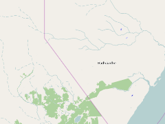
Tana-Kipini-Laga Badana Bush Bushle Land and Seascape
- Scientist: Josephat Nyongesa
- July 19, 2017, 5 p.m.
- Donor :
- Grant Ref :
- Members :
The Biodiversity Management Programme (BMP) is an initiative funded by European Commission (EC) through Intergovernmental Authority on Development (IGAD) aiming to contribute to poverty reduction by improving the social and economic wellbeing of the populations in IGAD region, through a better regional integration in the environmental sector.
The Biodiversity Management Programme (BMP) is an initiative funded by European Commission (EC) through Intergovernmental Authority on Development (IGAD) aiming to contribute to poverty reduction by improving the social and economic wellbeing of the populations in IGAD region, through a better regional integration in the environmental sector. Its purpose is the conservation and sustainable management of the ecosystems in the IGAD region, in order to contribute to lasting ecosystem goods and services. ICRAF is one of the BMP implementing partners and is managing one of the three projects in the Horn of Africa to develop collaborative management in 3 cross-boundaries land and seascapes between Kenya-Somalia, Djibouti-Ethiopia and Ethiopia-South Sudan. ICRAF is managing a 4 years Tana-Kipini-Laga Badana Bush Bushle Land and Seascape (North East Kenya and South East Somalia) project which commenced in November, 2013 and aims to contribute to poverty reduction by improving social and economic wellbeing of the populations in the IGAD region through better regional integration in environmental sector. The project implements 12 activities which focus on cross border exchange; Land Use Planning; Community conservation; Biodiversity value chains; Agroforestry interventions as key thematic areas.
Project layers, maps and documents
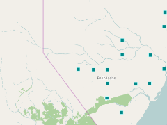
kudu_density_0_1_to_0_4
- March 15, 2017, 8:40 a.m.
The shapefile shows areas where Kudus could be found at the density of 0.1 to 0.4 km square, in Somalia coast for BMP project. The data source is from Abel N.O.J.(1976) strengthening of forestry and wildlife management project, Somalia management plan for the proposed national park, Bhadade district. United Nation development program food and agriculture organization of the United Nation Mogadishu. Revised November 2015.
kudu_density_0_5_to_0_8
- March 15, 2017, 8:40 a.m.
The shapefile shows areas where Kudus could be found at the density of 0.5 to 0.8 km square, in Somalia coast for BMP project. The data source is from Abel N.O.J.(1976) strengthening of forestry and wildlife management project, Somalia management plan for the proposed national park, Bhadade district. United Nation development program food and agriculture organization of the United Nation Mogadishu. Revised November 2015
kudu_density_1_3_to_1_6
- March 15, 2017, 8:41 a.m.
The shapefile shows areas where Kudus could be found at the density of 1.3 to 1.6 km square, in Somalia coast for BMP project. The data source is from Abel N.O.J.(1976) strengthening of forestry and wildlife management project, Somalia management plan for the proposed national park, Bhadade district. United Nation development program food and agriculture organization of the United Nation Mogadishu. Revised November 2015
kudu_density_1_7_to_2_0
- March 15, 2017, 8:42 a.m.
The shapefile shows areas where Kudus could be found at the density of 1.7 to 2.0 km square, in Somalia coast for BMP project. The data source is from Abel N.O.J.(1976) strengthening of forestry and wildlife management project, Somalia management plan for proposed national park, Bhadade district. United Nation development program food and agriculture organization of the United Nation Mogadishu. Revised November 2015.
kudu_seen_density_0_1_to_0_4_1
- March 15, 2017, 8:44 a.m.
The shapefile shows areas where Kudus are seen at the density of 0.1 to 0.4 km square, in Somalia coast for BMP project. The data source is from Abel N.O.J.(1976) strengthening of forestry and wildlife management project, Somalia management plan for the proposed national park, Bhadade district. United Nation development program food and agriculture organization of the United Nation Mogadishu. Revised November 2015
kudu_seen_density_1_7_to_2_0
- March 15, 2017, 8:44 a.m.
The shapefile shows areas where Kudus are seen at the density of 1.7 to 2.0 km square, in Somalia coast for BMP project. The data source is from Abel N.O.J.(1976) strengthening of forestry and wildlife management project, Somalia management plan for the proposed national park in Badhade district. United Nation development program food and agriculture organization of the United Nation Mogadishu. Revised November 2015.
laga_baadana_demonstration_site
- March 30, 2017, 1:11 a.m.
layer shows Laga Badana area in Somalia, one of demonstration site of BMP project funded by the IGAD

lagdera_plain
- March 30, 2017, 1:17 a.m.
The layer showing the Lag dera plain region at the Somalia coast. The data source is from Abel N.O.J.(1976) strengthening of forestry and wildlife management project, Somalia management plan for the proposed national park, Bhadade district. United Nation development program food and agriculture organization of the United Nation Mogadishu. Revised November 2015.

lake_kenyatta_demonstration_site
- March 30, 2017, 1:20 a.m.
Shows Lake Kenyatta area in Kenya, one of demonstration site of BMP project funded by the IGAD

limit_of_tsetsefly_survey
- March 30, 2017, 1:24 a.m.
The layer showing the areas with the Limit of Tsetse fly survey. The data source is from Abel N.O.J.(1976) strengthening of forestry and wildlife management project, Somalia management plan for the proposed national park, Bhadade district. United Nation development program food and agriculture organization of the United Nation Mogadishu. Revised November 2015.
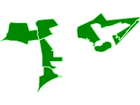
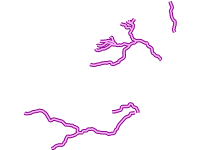
main_roads_of_bmp_somalia_side
- March 30, 2017, 1:38 a.m.
The main roads layer at the coast of Somalia where BMP project is located.
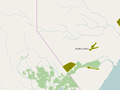
main_towns_in_the_project
- March 30, 2017, 1:42 a.m.
The layer consist of Witu, Lamu, Kiunga, Mindi and Dodori where BMP project sites is located

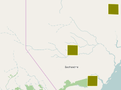
maishamasha_demonstration_site
- March 30, 2017, 3:33 a.m.
Shows Maisha Masha area in Kenya, one of demonstration site of IGAD BMP project.

manarani_site
- March 30, 2017, 3:36 a.m.
Shows Mararani area in Kenya, one of demonstration site of IGAD BMP project

manekora_lowland_dryforest
- March 30, 2017, 3:39 a.m.
The layer shows the manekora lowland dry forest along Kenyan coast.

mani_karsdiospyros_lowland_dryforest
- March 30, 2017, 3:48 a.m.
The layer shows the main Kar diospyros lowland dry forest along Kenyan coast.


marine_parks
- March 30, 2017, 3:53 a.m.
The showing coastal marine parks namely Kiunga and Ras Tenewi from Kenya wildlife services

mkunumbi_demonstration_site
- March 30, 2017, 3:55 a.m.
Shows Mkunumbi area in Kenya, one of demonstration site of IGAD BMP project

moa_demonstration_site
- March 30, 2017, 3:58 a.m.
Shows Mao area in Kenya, one of demonstration site of IGAD BMP project
natural_depression
- March 30, 2017, 4 a.m.
The BMP Natural regions pdf map was designed from Geoscience Lab for BMP project. The data source is from Abel N.O.J.(1976) strengthening of forestry and wildlife management project, Somalia management plan for proposed national park, Bhadade district. United Nation development program food and agriculture organization of the United Nation Mogadishu. Revised November 2015
pate_a_demonstration_site
- March 30, 2017, 4:02 a.m.
Shows Pate A area in Kenya, one of demonstration site of IGAD BMP project

pate_b_demonstration_site
- March 30, 2017, 4:06 a.m.
Shows Pate B area in Kenya, one of demonstration site of IGAD BMP project

proposed_demonstrative_sites
- March 30, 2017, 4:11 a.m.
The layer shows Kenya proposed demonstration site of BMP project funded by the IGAD


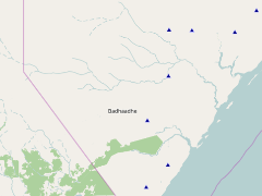
topi_seen_0_7_1_1_density
- March 30, 2017, 4:30 a.m.
The shapefile shows areas where Topi are seen at the density of 0.7 to 1.1 km square in Kenyan coast for BMP project. The data source is from Abel N.O.J.(1976) strengthening of forestry and wildlife management project, Somalia management plan for proposed national park, Bhadade district. United Nation development program food and agriculture organization of the United Nation Mogadishu. Revised November 2015

vegetation_density_0_1_0_4
- March 30, 2017, 4:30 a.m.
A point layer showing where the vegetation density was 0.1 to 0.4. The data source is from Abel N.O.J.(1976) strengthening of forestry and wildlife management project, Somalia management plan for proposed national park, Bhadade district. United Nation development program food and agriculture organization of the United Nation Mogadishu. Revised November 2015.

vegetation_density_0_5_0_8_1
- March 30, 2017, 4:31 a.m.
A point layer showing where the vegetation density was 0.5 to 0.8.The data source is from Abel N.O.J.(1976) strengthening of forestry and wildlife management project, Somalia management plan for the proposed national park, Bhadade district. United Nation development program food and agriculture organization of the United Nation Mogadishu. Revised November 2015.

vegetation_density_0_9_1_2
- March 30, 2017, 4:31 a.m.
A point layer showing where the vegetation density was 0.9 to 1.2. The data source is from Abel N.O.J.(1976) strengthening of forestry and wildlife management project, Somalia management plan for the proposed national park, Bhadade district. United Nation development program food and agriculture organization of the United Nation Mogadishu. Revised November 2015.

vegetation_density_1_3_1_6
- March 30, 2017, 4:32 a.m.
A point layer showing where the vegetation density was 1.3 to 1.6. The data source is from Abel N.O.J.(1976) strengthening of forestry and wildlife management project, Somalia management plan for the proposed national park, Bhadade district. United Nation development program food and agriculture organization of the United Nation Mogadishu. Revised November 2015.

vegetation_density_1_7_2_0
- March 30, 2017, 4:33 a.m.
A point layer showing where the vegetation density was 1.7 to 2.0. The data source is from Abel N.O.J.(1976) strengthening of forestry and wildlife management project, Somalia management plan for the proposed national park, Bhadade district. United Nation development program food and agriculture organization of the United Nation Mogadishu. Revised November 2015.
where_tsetsefly_was_caught
- March 30, 2017, 4:33 a.m.
The layer showing the areas where tsetse fly was caught. The data source is from Abel N.O.J.(1976) strengthening of forestry and wildlife management project, Somalia management plan for the proposed national park,Bhadade district. United Nation development program food and agriculture organization of the United Nation Mogadishu. Revised November 2015.

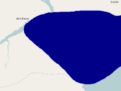
wilderness_zone_somalia
- March 30, 2017, 4:33 a.m.
The layer show the wilderness zones in Somalia side of the BMP project
witu_vegetation_map
- March 30, 2017, 4:34 a.m.
the layer show the vegetation map of the Witu demonstration site
witu_area_vegetation
- March 30, 2017, 4:35 a.m.
Layer showing the vegetation composition in Witu area

witu_demostration_site
- March 30, 2017, 4:35 a.m.
Layer showing Witu area, a site of the IGAD BMP project
witu_protected_area
- March 30, 2017, 4:35 a.m.
Layer showing Witu protected area which was one of the IGAD BMP demonstration site
wooded_and_bushed_grassland
- March 30, 2017, 4:36 a.m.
A layer showing Wooded and bushed grassland at the coast part of Somalia for BMP project. The data source is from Abel N.O.J.(1976) strengthening of forestry and wildlife management project, Somalia management plan for the proposed national park, Bhadade district. United Nation development program food and agriculture organization of the United Nation Mogadishu. Revised November 2015.
wooded_grassland_and_bushed_grassland
- March 30, 2017, 4:37 a.m.
A layer showing Wooded grassland and bushed grassland at the coast part of Somalia for BMP project. The data source is from Abel N.O.J.(1976) strengthening of forestry and wildlife management project, Somalia management plan for the proposed national park, Bhadade district. United Nation development program food and agriculture organization of the United Nation Mogadishu. Revised November 2015.
wooded_grassland_bushed
- March 30, 2017, 4:37 a.m.
A layer showing Wooded grassland and bushed grassland at the coast part of Somalia for BMP project. The data source is from Abel N.O.J.(1976) strengthening of forestry and wildlife management project, Somalia management plan for the proposed national park, Bhadade district. United Nation development program food and agriculture organization of the United Nation Mogadishu. Revised November 2015.
woodland
- March 30, 2017, 4:37 a.m.
A layer showing Wooded at the coast part of Somalia for BMP project. The data source is from Abel N.O.J.(1976) strengthening of forestry and wildlife management project, Somalia management plan for the proposed national park, Bhadade district. United Nation development program food and agriculture organization of the United Nation Mogadishu. Revised November 2015.
woodland_bushland
- March 30, 2017, 4:38 a.m.
A layer showing Wooded at the coast part of Somalia for BMP project. The data source is from Abel N.O.J.(1976) strengthening of forestry and wildlife management project, Somalia management plan for the proposed national park, Bhadade district. United Nation development program food and agriculture organization of the United Nation Mogadishu. Revised November 2015.
Kenya Coral_Colonies_Surveys_2015
- Nov. 21, 2016, 6:43 a.m.
This layer shows the number of juvenile coral colonies per meter square, medium coral colonies occupying an area of 21-80cm diameter colonies per 100m2 and mature colonies occupying an area of 81-320cm diameter colonies per 100m2.The data was compiled by CORDIO (Coastal Oceans research and development-Indian Ocean) with support from IGAD (Inter-Governmental Authority on Development BMP (Biodiversity Management Program) Implemented by ICRAF (World Agroforestry).

Kenya coral survey 1987
- Nov. 21, 2016, 7:08 a.m.
This layer shows the classification level 1 of the coral cover. It comprises coarse level of benthic classification and mean percentage coral cover.The data was compiled by CORDIO (Coastal Oceans research and development-Indian Ocean) with support from IGAD (Inter-Governmental Authority on Development BMP (Biodiversity Management Program) Implemented by ICRAF (World Agroforestry).

Kenya Coral Benthos Survey 1999 to 2008
- Nov. 21, 2016, 6:05 a.m.
This layer shows classification level 1 which means coarse level of benthic classification for Coral Benthos showing the numbers of samples, mean percentages of coral cover types and the standard deviation of its mean. The data was compiled by CORDIO (Coastal Oceans research and development-Indian Ocean) with support from IGAD (Inter-Governmental Authority on Development BMP (Biodiversity Management Program) Implemented by ICRAF (World Agroforestry).

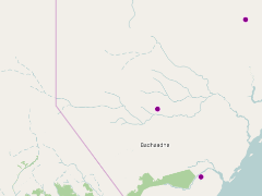
mondane_range
- April 26, 2017, 6:13 a.m.
The shapefile shows the Mondane range found at the kenyan coast.
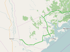
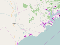
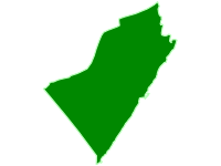
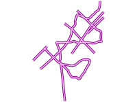
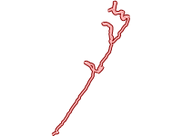
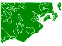
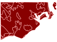
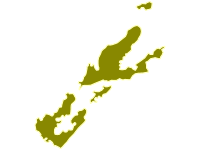
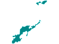
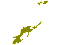
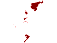
IGAD_BMP project area boundary
- Jan. 10, 2018, 3:02 a.m.
This boundary was determined from The Tana-Kipini-LagaBadanaBushbush land and seascape boundary for a huge diversity of ecosystems from coral reefs and mangroves to coastal forests, riverine forests, wetlands, acacia woodland, coastal scrub and, semi-desert. It covers coast part of Kenya and Somalia.
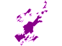
IGAD BMP Project boundaries
- Jan. 10, 2018, 3:35 a.m.
The Biodiversity Management Programme (BMP) is an initiative funded by European Commission (EC) through Intergovernmental Authority on Development (IGAD) aiming to contribute to poverty reduction by improving the social and economic wellbeing of the populations in IGAD region, through a better regional integration in the environmental sector.

Database for Lag Badana flora and fauna
- July 10, 2017, 1:53 a.m.
IGAD BMP implemented by ICRAF conducted an assessment to generate the data which describes the terrestrial and marine biodiversity of the cross-border landscape in the Lag Badana Bushbushle National Park. The findings revealed that 1440 plant and animal species are recorded in the area of the proposed national park. There are 916 species belonging to 446 genera and 110 families that have been recorded in the area of the national park and the adjacent floodplain of the lower Juba valley.

Flora and Fauna of Witu Forest Ecosystem
- July 10, 2017, 3:32 a.m.
The data sheet provides a list of flora and fauna in Witu Forest Ecosystem funded by IGAD BMP project implemented by World Agroforestry Centre.
Recent Posts
We work towards the application of GeoScience in real decision contexts, such as climate change adaptation, hydrological effects of changes in climate and land cover, targeting of agroforestry interventions, provision of soil fertility and surveillance advisory services for smallholder farmers, digital soil and land use/cover mapping, and measuring impacts of interventions, all using open source software.