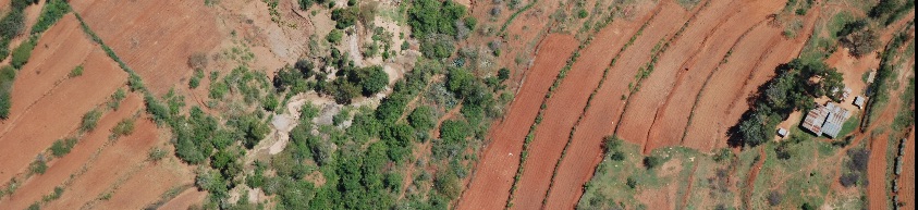
During the "Kenya Landuse Change" project conducted by the Climate Change Unit at ICRAF, several thousand aerial images were collected from surveys done in 1983 and 2012, respectively. During the last three months, the ICRAF GeoScience Lab has georeferenced this image archive to an accuracy of ~5m or better, with the help of six interns ...
Author archives: muhammad
Aerial images from Kenya georeferenced by the ICRAF GeoScience Lab
Written by , on Feb. 11, 2015 in GIS, Software.
Last update on Feb. 11, 2015.
Landscape portal at annual CGIAR-CSI meeting, Enschede
Written by on Oct. 14, 2014 in Workshop.
Last update on Oct. 28, 2014.
The ICRAF GeoScience Lab (GSL) recently participated in the CGIAR CSI meeting in Enschede, the Netherlands. During
this meeting, the Landscapes Portal was presented (presentation link)
along with some of its salient features (e.g time series tools, blog module etc.).
CGIAR is in the process of finalizing its Open Data policy and soon all ...
After six months (of inauguration, version 3), our data portal is growing day by day. About two months back we created an extent map of all the data sets in our portal (see below).
This time we decided to create a video. It shows the extent of all the data sets in landscape portal.
Cool ...
Usage statistics for the Landscapes Portal
Written by on June 4, 2014 in GIS, New maps.
Last update on June 26, 2014.
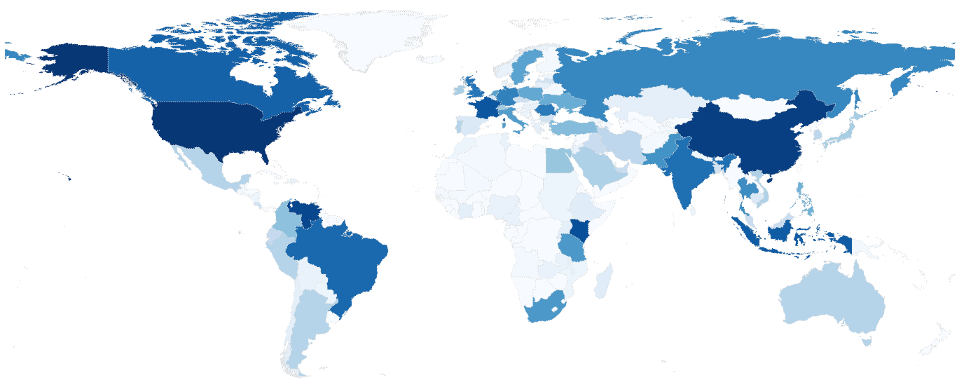
The Landscapes Portal is growing rapidly. Into our fourth month, the Landscapes Portal has around five hundred unique data sets with complete meta-data and more than two hundred registered users that are uploading and sharing spatial data and maps. We saw a lot of interest in the last two months with more than four thousand ...